5. Contamination and Toxic Substances [24 CFR 50.3(i) & 58.5(i)(2)]
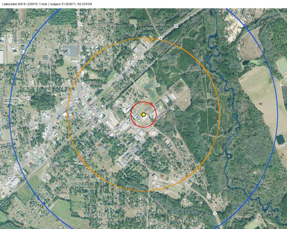
Human requiredNo listed sites in the search radii — site does not appear impacted (pending Part I site observation).
- Part I: record the site inspection finding — any obvious signs of hazardous/toxic materials from the public right of way?
- Part II: 3 listed record(s) in this city have no coordinates — check they are not near the site.
- IV Radon: Pierce County listed 'No' on the DCA form. (Radon review concluded)
- V Lead-based paint: built 1965 (before 1978) → LBP testing required by a Georgia-certified firm.
- VI Asbestos: answered during work; standard asbestos condition applies.
Findings & evidence
| listed_sites_in_search_radii | [] NPL/CERCLA/state list ≤ 5,280 ft; facilities/landfills/cleanups ≤ 3,000 ft |
| reference_datasets | {
"epa_sems_ga": {
"title": "EPA SEMS sites (Superfund: NPL, non-NPL, archived) \u2014 Georgia",
"url": "https://data.epa.gov/dmapservice/sems.envirofacts_site/fk_ref_state_code/equals/GA/JSON",
"file": "epa_sems_ga.json",
"sha256": "c6340bfacc3c19c54aaef8a25bb7b78e5f3a03a79fb6c78446fc6873c1b722e4",
"retrieved_at": "2026-10-29T16:29:00.332955+00:00",
"bytes": 1227310
},
"epa_cimc": {
"title": "EPA Cleanups in My Community (Superfund, RCRA corrective action, brownfields, federal facilities)",
"url": "https://dmap-prod-oms-edc.s3.amazonaws.com/OLEM/OLEM-OPM/cimc_all_sites.parquet",
"file": "epa_cimc.parquet",
"sha256": "ae1e7b514c8a94ed81ba08d31690db8df2d5dc5f946763b17fee6f877d666481",
"retrieved_at": "2026-10-29T16:29:01.310288+00:00",
"bytes": 10175438
},
"ga_hsi": {
"title": "Georgia EPD Hazardous Site Inventory (HSI)",
"url": "https://epd.georgia.gov/document/document/hazardous-site-inventory-2026/download",
"file": "ga_hsi.xlsx",
"sha256": "b1b41eac9da30ea6fed4011ae98e35a49f26b2a784a9da194ab8fa37a2eab514",
"retrieved_at": "2026-10-29T16:29:01.891238+00:00",
"bytes": 76539
},
"ga_solid_waste": {
"title": "Georgia EPD Regulated Solid Waste Facilities",
"url": "https://epd.georgia.gov/media/148276/download",
"file": "ga_solid_waste.xlsx",
"sha256": "2f575912147817647469dcfb66cc2ca125736409cc2c570ec621df5a5511fd05",
"retrieved_at": "2026-10-29T16:29:02.206493+00:00",
"bytes": 665216
}
} |
| unmapped_records_same_city | [
{
"name": "CITY OF BLACKSHEAR",
"address": "3400 FLOYD DRIVE BLACKSHEAR GA 31516",
"category": "GA EPD solid waste: SW- Yard Trimming Landfill (Operating)"
},
{
"name": "CITY OF BLACKSHEAR - PINEY GROVE INERT LANDFILL",
"address": "5358 BROWN'S LANE BLACKSHEAR GA 31516",
"category": "GA EPD solid waste: SW- Inert Landfill (In-Closure)"
},
{
"name": "PIERCE COUNTY BOC - HIGHWAY 38 INERT LF",
"address": "LOCATED ON THE OUTER BOUNDARY OF THE COUNTY LANDFILL OFF GA HI BLACKSHEAR GA 31516",
"category": "GA EPD solid waste: SW- Inert Landfill (Operating)"
}
]Records with no usable coordinates whose address mentions the subject city; not distance-tested. |
8. Historic Preservation [NHPA Section 106; 36 CFR 800]
Human requiredSHPO determination needed. Tribal: rehabilitation/MHU replacement with no undisturbed ground — review concluded.
- Part I (SHPO): does the scope of work meet a First Tier allowance in DCA's programmatic agreement? If not, a Second Tier memo signed by an SOI-qualified person, or Section 106 consultation with SHPO, is required.
- Building is 61 years old (≥ 45) — potential historic property.
- v1 will pre-screen the scope of work against the First Tier allowances (AI-assisted, human-confirmed).
Findings & evidence
| building_age_years | 61 |
Project information and location
Needs reviewProject information recorded.
- Confirm the pin sits on the correct parcel/structure (Census geocoder interpolates along the street).
- Inputs need confirmation.
Findings & evidence
| matched_address | "312 NICHOLS ST, BLACKSHEAR, GA, 31516" evidence: 00-census-geocoder.json |
| coordinates | {
"lat": 31.303971218313,
"lon": -82.234158632507
} |
| county | "Pierce" |
| location_precision | "street_range_interpolated" |
| year_built | 1965 |
| activity | "rehabilitation" |
| repair_cost | 35000.0 |
| structure_value | 90000.0 |
1. Airport Hazards [24 CFR Part 51 Subpart D]
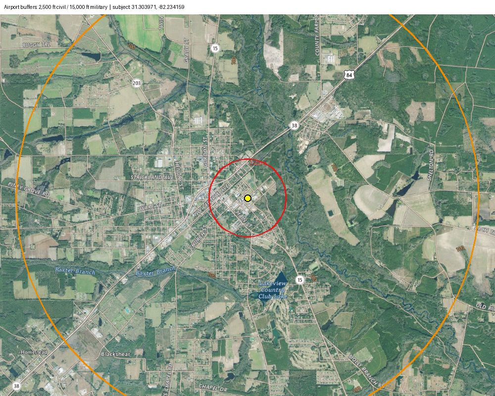
Auto-clearProject not located within 15,000 feet of a military airport or 2,500 feet of a civilian airport. (Review concluded)
- No public-use civil airport within 2,500 ft and no military airfield within 15,000 ft (searched 5 mi; FAA AIS data).
Findings & evidence
| nearest_airports | [] Distances are to the FAA airport reference point, not the runway/clear zone. evidence: 03-faa-ais-us-airports.json |
3. Flood Insurance [Flood Disaster Protection Act / NFIRA]
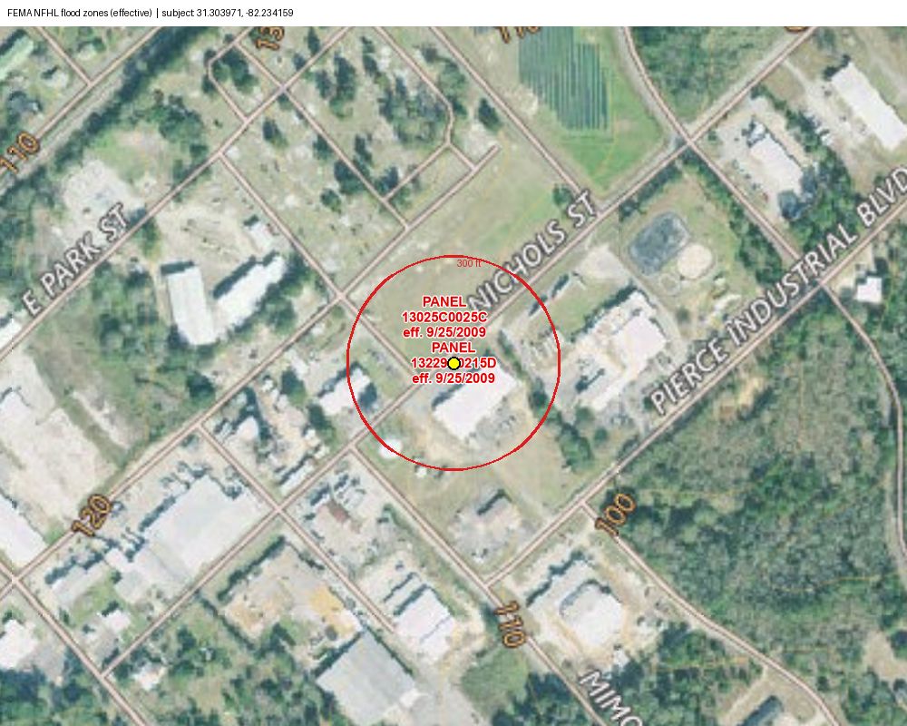
Auto-clearStructure not located in a Special Flood Hazard Area. Flood insurance not required. (Review concluded)
- FIRM zone is outside the SFHA (not A/AE/V/VE).
Findings & evidence
| firm_zone | [ "X (AREA OF MINIMAL FLOOD HAZARD)" ] evidence: 01-fema-nfhl-flood-hazard-zones-point.json, 02-fema-nfhl-flood-hazard-zones-boundary-check.json, 05-fema-nfhl-firm-panels.json |
| firm_panel | "13229C0215D" |
| firm_panel_effective_date | "2009-09-25" |
| zones_within_boundary_buffer | [ "X|AREA OF MINIMAL FLOOD HAZARD" ] |
6. Endangered Species Act [Section 7; 50 CFR 402]
Auto-clearRehabilitation (not reconstruction/replacement): ESA conditions required. (Review concluded)
7. Floodplain Management [EO 11988, 24 CFR Part 55]
Auto-clearNot in FFRMS floodplain (0.2-percent-annual-chance approach). Complies with EO 11988, 24 CFR 55, 58.6. (Review concluded)
- Point is outside the SFHA and the 0.2% (shaded X) zone.
- Limitation (v0): preliminary FIRMs, CISA and Freeboard (FVA) approaches are not checked automatically; the 0.2-percent-annual-chance approach is used.
Findings & evidence
| firm_zone | [ "X (AREA OF MINIMAL FLOOD HAZARD)" ] evidence: 01-fema-nfhl-flood-hazard-zones-point.json, 02-fema-nfhl-flood-hazard-zones-boundary-check.json, 05-fema-nfhl-firm-panels.json |
| firm_panel | "13229C0215D" |
| firm_panel_effective_date | "2009-09-25" |
9. Wetlands Protection [EO 11990]
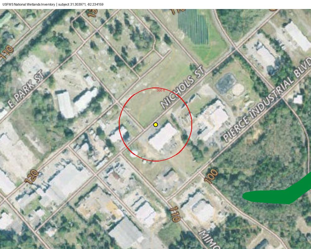
Auto-clearNot located in a mapped wetland (USFWS NWI). (Review concluded)
Findings & evidence
| nwi_at_point | [] evidence: 04-usfws-nwi-wetlands-point.json, 06-usfws-nwi-wetlands-buffer.json |
| nwi_within_50_ft | [] |
10. Mitigation Measures and Conditions
Auto-clear6 condition(s) apply.
- Use the exact condition wording from the DCA Tier 1 mitigation table.
Findings & evidence
| conditions | [ "Construction dust/emission BMPs \u2014 see Tier 1 mitigation table.", "HUD recommends NFIP flood insurance for all insurable structures \u2014 see Tier 1 mitigation table.", "Pre-1978 (or unknown age): LBP risk assessment by a Georgia-certified firm; attach report \u2014 see Tier 1 mitigation table.", "If suspected ACM is found during work: comply with federal/state/local asbestos rules \u2014 see Tier 1 mitigation table.", "Endangered Species Act standard conditions \u2014 see Tier 1 mitigation table.", "Historic preservation project conditions if required by SHPO/allowance \u2014 see Tier 1." ] |
2. Coastal Barrier Resources [CBRA]
Not applicableNot applicable — county not in the CBRS county list (Bryan, Chatham, Liberty, Glynn).
4. Coastal Zone Management [CZMA]
Not applicableNot applicable — not a Georgia coastal management county.
Evidence log (17 files)
| Census Geocoder | 00-census-geocoder.json | 2026-10-29T16:30:36 | fa58e08e8a8dea92… |
| FEMA NFHL Flood Hazard Zones (point) | 01-fema-nfhl-flood-hazard-zones-point.json | 2026-10-29T16:30:37 | 4f84b281b7d06297… |
| FEMA NFHL Flood Hazard Zones (boundary check) | 02-fema-nfhl-flood-hazard-zones-boundary-check.json | 2026-10-29T16:30:37 | 4f84b281b7d06297… |
| FAA AIS US Airports | 03-faa-ais-us-airports.json | 2026-10-29T16:30:37 | 1fc423ae159c0a61… |
| USFWS NWI Wetlands (point) | 04-usfws-nwi-wetlands-point.json | 2026-10-29T16:30:37 | ae982613ccf8efe3… |
| USFWS NWI Wetlands (buffer) | 06-usfws-nwi-wetlands-buffer.json | 2026-10-29T16:30:37 | ae982613ccf8efe3… |
| FEMA NFHL FIRM Panels | 05-fema-nfhl-firm-panels.json | 2026-10-29T16:30:37 | 53d5512fdd03de5f… |
| USGS basemap for flood | 07-usgs-basemap-for-flood.png | 2026-10-29T16:30:39 | ffb3a1e25cdeb17f… |
| flood overlay for flood | 08-flood-overlay-for-flood.png | 2026-10-29T16:30:39 | 5a25132df84b47a9… |
| Exhibit: FEMA NFHL flood zones (effective) | exhibit-flood.png | 2026-10-29T16:30:39 | 1a0711a842ec2057… |
| USGS basemap for wetlands | 09-usgs-basemap-for-wetlands.png | 2026-10-29T16:30:41 | ffb3a1e25cdeb17f… |
| wetlands overlay for wetlands | 10-wetlands-overlay-for-wetlands.png | 2026-10-29T16:30:41 | 3a56eed500581ac7… |
| Exhibit: USFWS National Wetlands Inventory | exhibit-wetlands.png | 2026-10-29T16:30:41 | e6b706a985d213f2… |
| USGS basemap for contamination | 11-usgs-basemap-for-contamination.png | 2026-10-29T16:30:43 | dd706eebf8427546… |
| Exhibit: Listed sites: 500 ft / 3,000 ft / 1 mile | exhibit-contamination.png | 2026-10-29T16:30:43 | cd75644b5e696e52… |
| USGS basemap for airport | 12-usgs-basemap-for-airport.png | 2026-10-29T16:30:44 | 1c0c7daada5992a7… |
| Exhibit: Airport buffers: 2,500 ft civil / 15,000 ft military | exhibit-airport.png | 2026-10-29T16:30:44 | 224e47ce7393427b… |
Draft prepared by automated lookups for reviewer verification. Not a final determination; the Responsible Entity's certifying officer signs.